Description
Added on the 20/12/2016 16:37:52 - Copyright : RT Ruptly EN
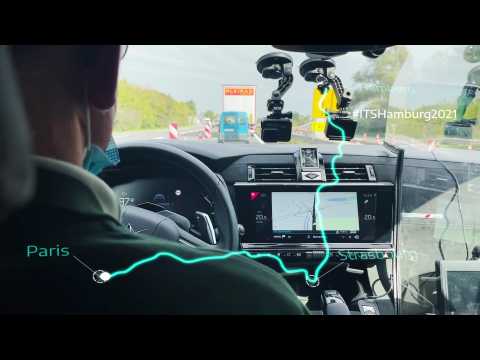
At SAE Level 3 the driver does not need to monitor the driving situation constantly but must take back control when the system requests. L3Pilot, the flagship research and innovation project in Europe, is one of the most important for the future of automated driving since it is focused on testing and evaluating the technology as a safe and efficient means of transportation in real traffic conditions. It also assessed technical aspects, driving behavior, user acceptance and impact on traffic and safety.The piloting phase covered a wide range of driving situations, including parking, overtaking on highways, driving through urban intersections and in close distance scenarios. This tested Level 3 automated driving functions such as:Motorway Chauffeur: High-speed driving and automated lane changeTraffic Jam Chauffeur: Low-speed driving in congested roadsRemote Parking: In parallel and cross-parking scenariosHome Zone: Path memory for repetitive maneuvers to park in and out in parking areas
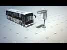
Singapore announced on Wednesday that the country will begin testing autonomous buses on the road in 2018.

Subscribe for more car videos: http://bitly/AutoMotoTV Mercedes-Benz Future Bus - Autonomous Driving & Traffic Light Recognition | AutoMotoTV Follow us ...
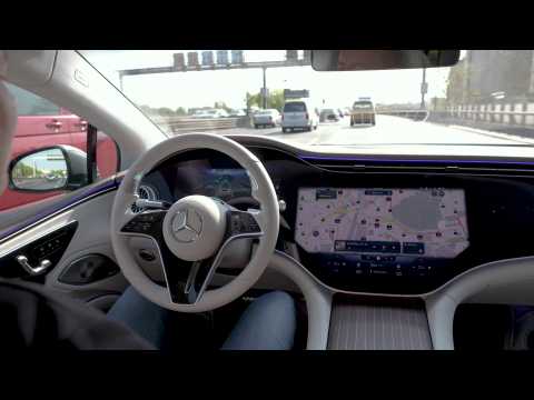
The exact location of a Mercedes equipped with DRIVE PILOT is determined using a high-precision positioning system that is much more powerful than conventional GPS systems. In addition to the anonymised data collected by LiDAR, camera, radar and ultrasound sensors, a digital HD map provides a three-dimensional image of the road and the surroundings with information on road geometry, route characteristics, traffic signs and special traffic events (e.g. accidents or road works). This high-precision map differs from maps for navigation devices by, among other things, its higher accuracy in the centimetre rather than metre range and its detailed junction and route model. The map data is stored in backend data centres and updated constantly. Each vehicle also stores an image of this map information on board, constantly compares it with the backend data and updates the local dataset as required. All of this enables stable and accurate positioning through a representation of the surroundings that is independent of factors such as shadows or dirty sensors.

The exact location of a Mercedes equipped with DRIVE PILOT is determined using a high-precision positioning system that is much more powerful than conventional GPS systems. In addition to the anonymised data collected by LiDAR, camera, radar and ultrasound sensors, a digital HD map provides a three-dimensional image of the road and the surroundings with information on road geometry, route characteristics, traffic signs and special traffic events (e.g. accidents or road works). This high-precision map differs from maps for navigation devices by, among other things, its higher accuracy in the centimetre rather than metre range and its detailed junction and route model. The map data is stored in backend data centres and updated constantly. Each vehicle also stores an image of this map information on board, constantly compares it with the backend data and updates the local dataset as required. All of this enables stable and accurate positioning through a representation of the surroundings that is independent of factors such as shadows or dirty sensors.


 |
Support : Technical
|
Support : Technical  - Content
  - Editors