Description
Added on the 21/09/2018 16:04:52 - Copyright : Wochit
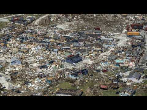
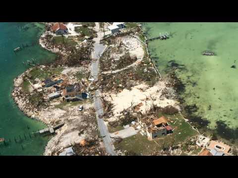
Aerial images show the floods and damages from Hurricane Dorian on Freeport, Grand Bahama. Hurricane Dorian cut a swath through the northern Bahamas, where it left at least 20 people dead and thousands homeless. IMAGES
A US Coast Guard employee, Chief Petty Officer Brad Fitzpatrick rescued two people and six dogs from a flooded home in Wilmington, North Carolina, after Hurricane Florence and its remnants swept through the area. He worked with other aircrews throughout the day in extreme conditions, encountering submerged barbed wire fencing, floating fire-ant beds, and chest-deep water to save people and animals from the devastation wrought by Hurricane Florence.

Inondations : Nîmes sauvée des eaux
Aerial images show the destruction in the Bahamas after the Caribbean nation was ravaged by Hurricane Dorian. Dorian was a Category 5 hurricane -- the highest on the five-level wind scale -- when it hit the northern Bahamas, leaving a trail of destruction and killing at least 20 people. IMAGES
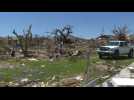
Homes are left with no roofs and debris litter the ground after Hurricane Dorian ripped across Great Abaco Island in the Bahamas. The hurricane killed at least 20 people in the archipelago. IMAGES
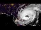
The National Oceanic and Atmospheric Administration (NOAA) releases a 5-hour loop captured by its satellite on Wednesday, September 4, showing Hurricane Dorian moving along the US coast after killing at least 7, in the Bahamas. IMAGES SATELLITE IMAGES


 |
Support : Technical
|
Support : Technical  - Content
  - Editors