Description
Added on the 05/09/2019 13:05:40 - Copyright : AFP EN
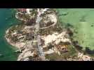
Aerial images show the floods and damages from Hurricane Dorian on Freeport, Grand Bahama. Hurricane Dorian cut a swath through the northern Bahamas, where it left at least 20 people dead and thousands homeless. IMAGES
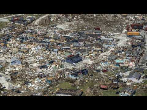
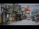
Aerial images show the destruction in the Bahamas after the Caribbean nation was ravaged by Hurricane Dorian. Dorian was a Category 5 hurricane -- the highest on the five-level wind scale -- when it hit the northern Bahamas, leaving a trail of destruction and killing at least 20 people. IMAGES
Homes are left with no roofs and debris litter the ground after Hurricane Dorian ripped across Great Abaco Island in the Bahamas. The hurricane killed at least 20 people in the archipelago. IMAGES
Aerial footage shot from a US Coast Guard aircraft shows widespread flooding in the Bahamas after Hurricane Dorian tore through the archipelago, killing at least seven people and causing widespread damage. IMAGES
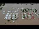
Aerial images show severe flooding in the area surrounding San Pedro Sula, northern Honduras, due to the overflowing of the Chamelecon River after the passage of Hurricane Iota. AERIAL IMAGES

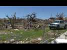
Snapped trees, dilapidated homes and smashed cars stand out among the debris in Marsh Harbour following Hurricane Dorian. Bahamas authorities have updated the death toll to 50 with the number expected to climb, local media reports, as thousands are evacuated from the archipelago's hardest-hit islands. IMAGES


 |
Support : Technical
|
Support : Technical  - Content
  - Editors