Description
Added on the 06/09/2019 23:05:45 - Copyright : AFP EN
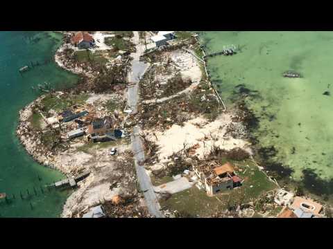
Aerial images show the destruction in the Bahamas after the Caribbean nation was ravaged by Hurricane Dorian. Dorian was a Category 5 hurricane -- the highest on the five-level wind scale -- when it hit the northern Bahamas, leaving a trail of destruction and killing at least 20 people. IMAGES
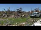
Homes are left with no roofs and debris litter the ground after Hurricane Dorian ripped across Great Abaco Island in the Bahamas. The hurricane killed at least 20 people in the archipelago. IMAGES
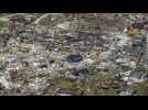
Aerial images show the floods and damages from Hurricane Dorian on Freeport, Grand Bahama. Hurricane Dorian cut a swath through the northern Bahamas, where it left at least 20 people dead and thousands homeless. IMAGES
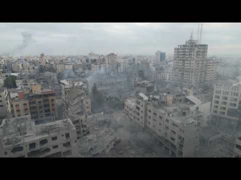
Aerial images filmed with a drone show destruction in Gaza City, as Israel continues to pound Hamas targets in Gaza Tuesday. IMAGES
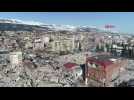
Aerial images of widespread destruction in the city of Kahramanmaras, one of the hardest-hit spots in Turkey's devestated southeast. Shows rescue teams working to clear the rubble. IMAGES
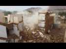
Aerial images show destruction in Yemen's historic Tarim city, where four people died by flash floods as a result of heavy rains. The city, located in the central province of Hadramawt, is best known for its mud-brick structures and more than 360 mosques -- including Al-Mehdar, which has the tallest minaret in the country. 1st IMAGES


 |
Support : Technical
|
Support : Technical  - Content
  - Editors