Description
Added on the 18/08/2022 13:06:48 - Copyright : Euronews EN
Hurricane Norma strengthened to a Category 3 storm as it approaches a tourist hotspot on Mexico's Pacific coast. The hurricane -- which at one point was a Category 4 out of five on the Saffir-Simpson scale -- is now packing maximum sustained winds of 195 kilometers per hour (120 miles per hour), the US National Hurricane Center says in its latest update. IMAGES

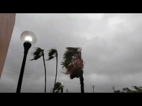
Furious winds whip the coastline by the Montauk Point Light on the easternmost point of Long Island, as tropical storm Henri approaches. IMAGES
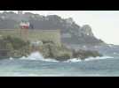
While Météo-France has placed the Alpes-Maritimes department on red alert for rain and floods, the southern causeway of the Promenade des Anglais - the beachfront esplanade in Nice - is closed. IMAGES

Several hundred people are taking part in a white march in Aiguillon in Lot-et-Garonne to pay tribute to the 25-year-old gendarme who was mowed down last weekend by a hit-and-run driver trying to evade a road check. IMAGES

French President Emmanuel Macron travelled Tuesday to the hurricane-hit Caribbean, joining the Dutch king in the region for a tour of the devastated islands. SOUNDBITE

Les "Hurricane Hunters" de l'US Air Force ont traversé l'ouragan Melissa.


 |
Support : Technical
|
Support : Technical  - Content
  - Editors