Description
Added on the 04/10/2016 13:55:10 - Copyright : Viral Video Online
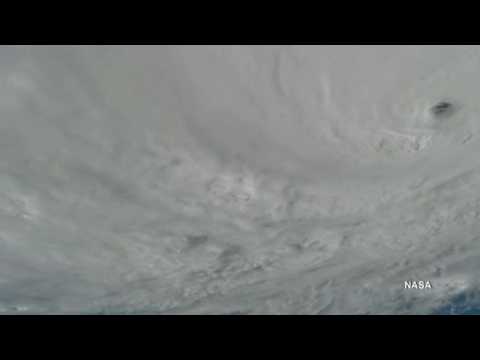
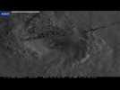
NASA footage from the International Space Station shows Hurricane Matthew en route to Haiti
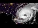
The National Oceanic and Atmospheric Administration (NOAA) releases a 5-hour loop captured by its satellite on Wednesday, September 4, showing Hurricane Dorian moving along the US coast after killing at least 7, in the Bahamas. IMAGES SATELLITE IMAGES
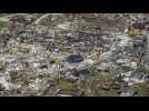
Aerial images show the floods and damages from Hurricane Dorian on Freeport, Grand Bahama. Hurricane Dorian cut a swath through the northern Bahamas, where it left at least 20 people dead and thousands homeless. IMAGES
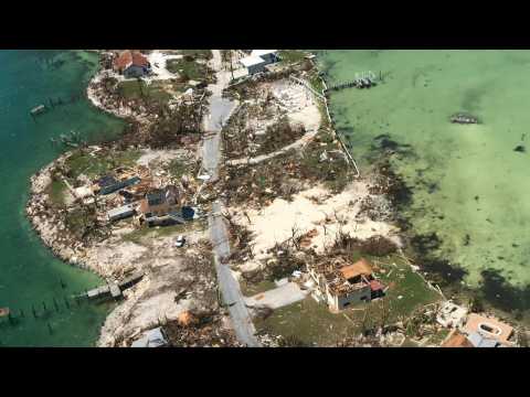
Aerial images show the destruction in the Bahamas after the Caribbean nation was ravaged by Hurricane Dorian. Dorian was a Category 5 hurricane -- the highest on the five-level wind scale -- when it hit the northern Bahamas, leaving a trail of destruction and killing at least 20 people. IMAGES
Hurricane Irma's eyewall slams into the Florida Keys, lashing the island chain with fearsome wind gusts as it bears down on the state's west coast where a mass exodus has turned cities into ghost towns. IMAGES of Satellite footage showing Hurricane Irma

U.S. President Barack Obama attends an outdoor arrival ceremony in heavy rain, as the first sitting U.S. president to visit Laos. Rough Cut (no reporter narration).


 |
Support : Technical
|
Support : Technical  - Content
  - Editors